Looking out over Geographe Bay, Cape Naturaliste Lighthouse has the appearance of a quaint, watchful stone sentinel. Constructed from local limestone, the picturesque lighthouse offers vistas of the ocean, the coastline’s charming beaches, and the walking trails that snake around the promontory on which the building sits. At its highest point, Cape Naturaliste Lighthouse is 123 m (404 ft) above sea level.
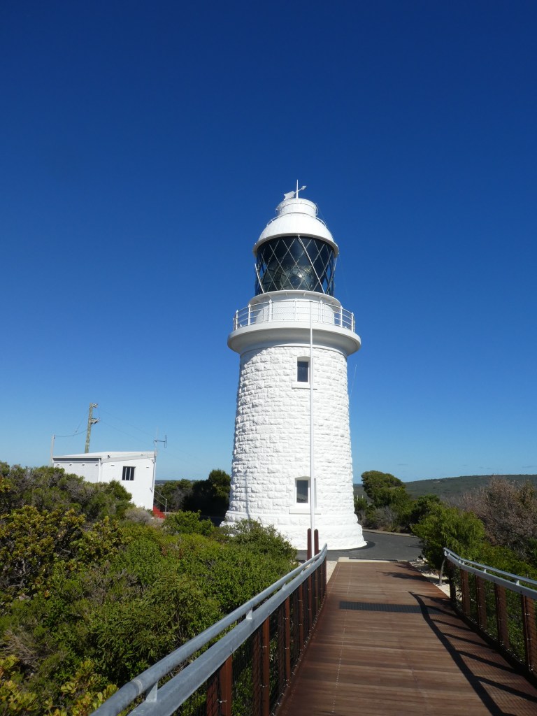
Cape Naturaliste Lighthouse was the last manned lighthouse on mainland Australia and is one of the few operational lighthouses the public can access.
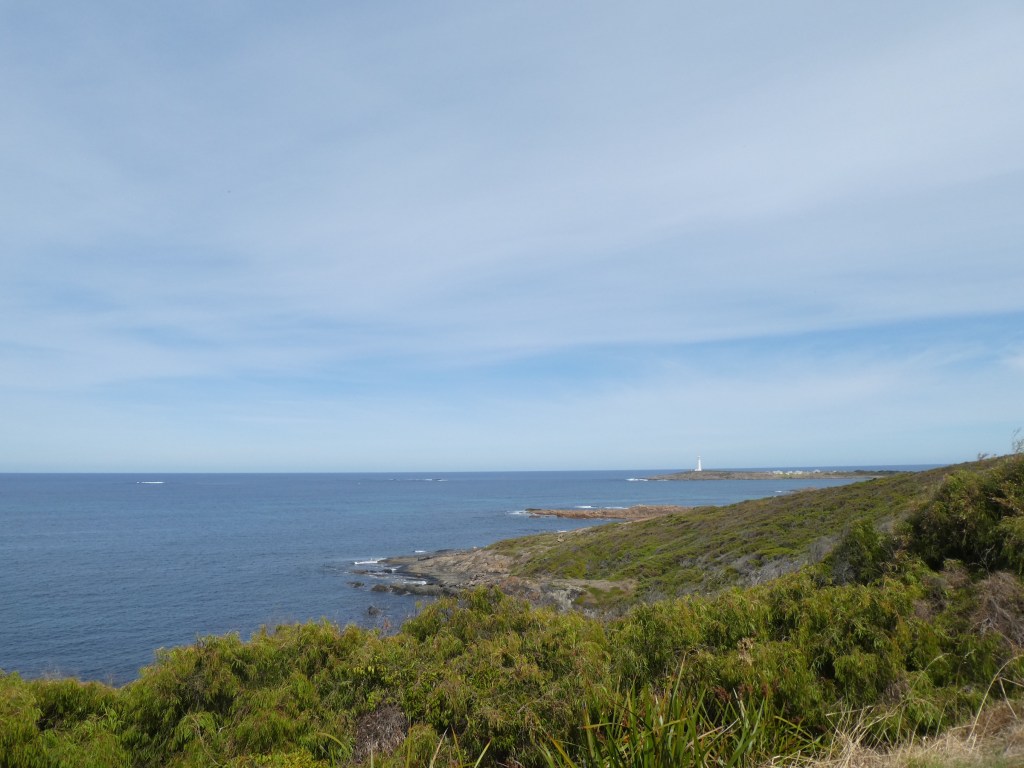
The lighthouse stands on a 100m high bluff overlooking Geographe Bay and affords breathtaking views across the Indian Ocean and the Leeuwin-Naturaliste National Park. From the balcony, whales and their young can be spotted playing in the waters below during their annual migration, from September to December.
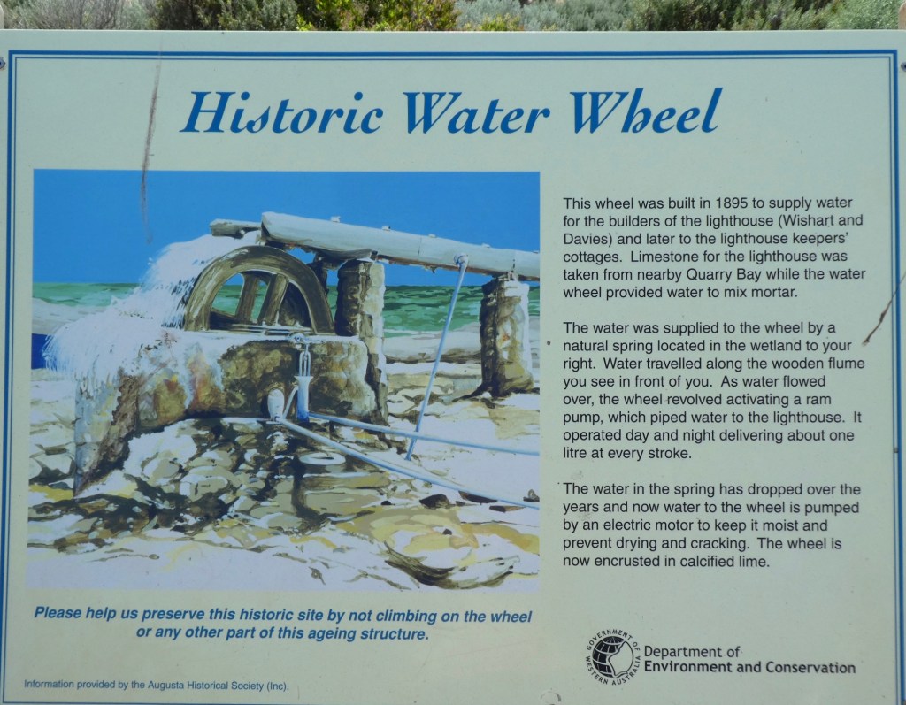
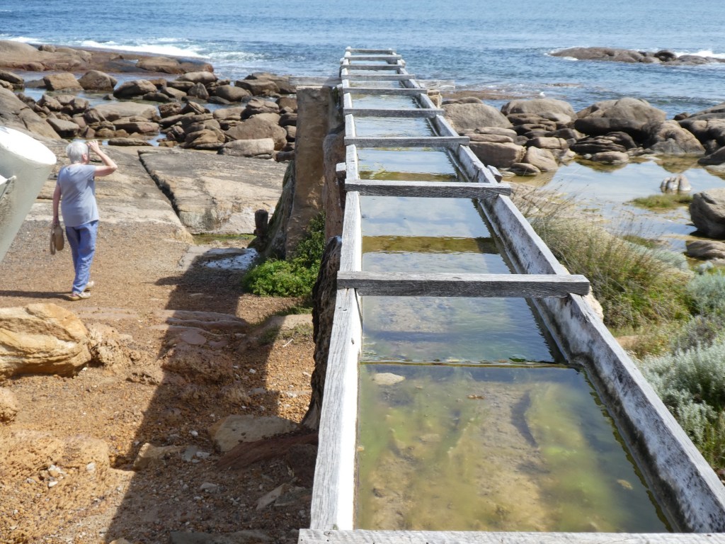
Three keepers and their families originally lived and worked at Cape Naturaliste Lighthouse and the three original lightkeepers’ quarters are still standing. Life revolved around night watches which were divided into three periods, one for each man. During each watch the keeper had to wind the mechanism and then pump paraffin to the burner.
Life was hard for lightkeepers and their families. With no paid annual leave or travel assistance, lightkeepers remained at their isolated stations for many years. Once a fortnight stores and supplies were delivered from Busselton, including classwork for the children who were home schooled. The light was converted to automatic operation in July 1978 and the last lighthouse keeper, Max Nethery, left in 1996.
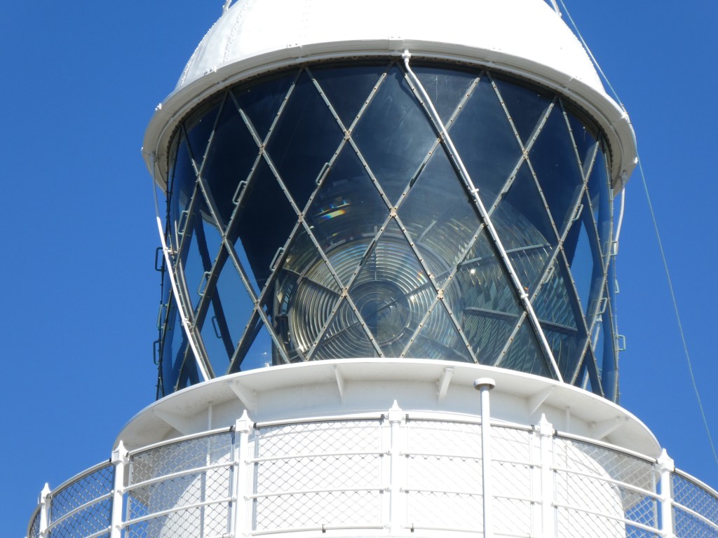
Cape Naturaliste Lighthouse
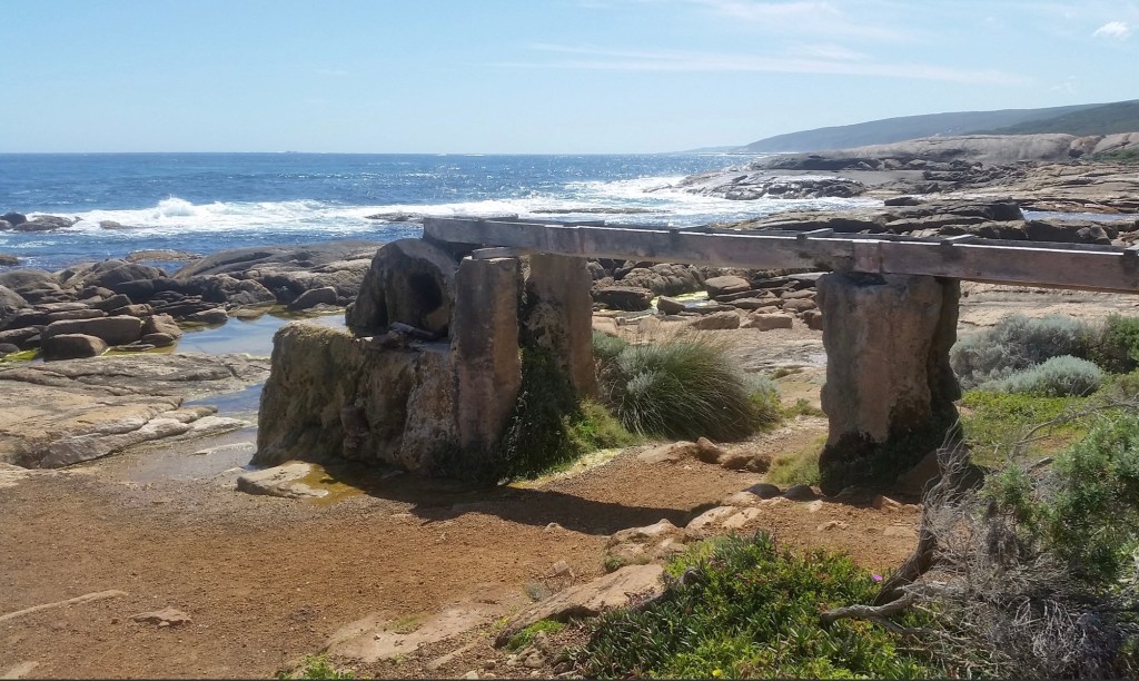
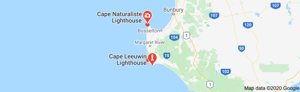
The Cape to Cape Bush Walk Track runs for 123 kilometres along the Leeuwin-Naturaliste Ridge, between the lighthouses of Cape Naturaliste and Cape Leeuwin in the far south west of Western Australia. It features spectacular coastal and forest scenery, a fascinating geology of cliffs, caves, headlands and rock formations and an ever-changing display of vegetation and wildflowers.
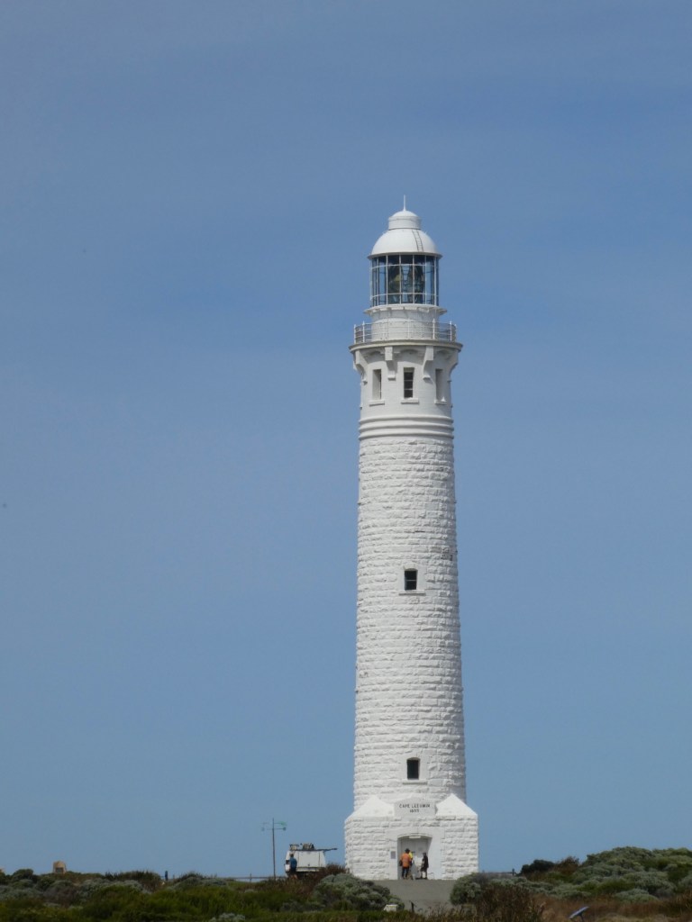
https://lighthouses.org.au/wa/cape-leeuwin-lighthouse/
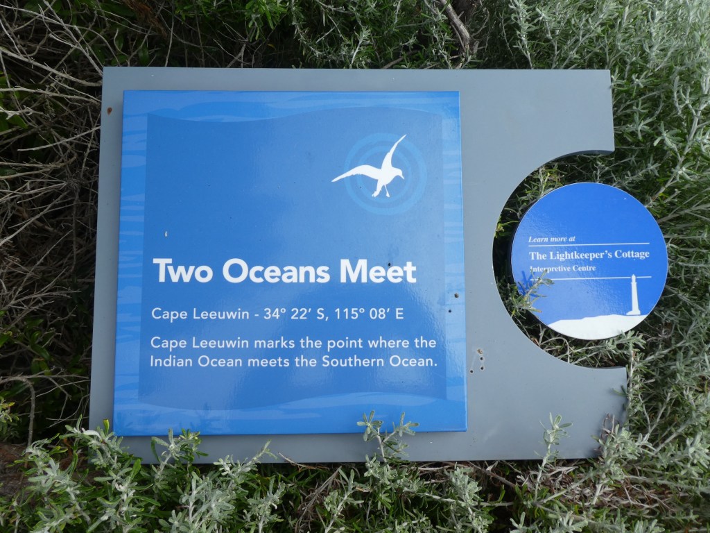
There are five oceans on earth, and all of them are connected with each other to form a continuous body of water. Historically, there were only four oceans, namely Atlantic, Pacific, Indian and Arctic. In the year 2000, the International Hydrographic Organization decided to carve out a new ocean surrounding the least populated continent at the bottom of the earth—Antarctica—based on the evidence that this water body has a distinct ecosystem and a unique impact on global climate. The Antarctic Ocean, also called the Southern Ocean, became the fifth ocean on earth and the fourth largest of the world’s five oceans, larger than the Arctic Ocean.